La Sarre Gold Project
Goldcana has entered an option to acquire up to a 100% interest in the La Sarre Gold Project — a district-scale gold exploration opportunity in Québec's Abitibi Greenstone Belt, with approximately 185 historical drill holes, multiple mineralized showings, 33 AI-ranked targets, and a near-term focus on the North Ligneris / Disson corridor.
Strategic Land Position in the Abitibi
Regionally Strategic, Locally Accessible
Location
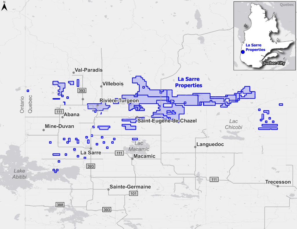
Abitibi-Témiscamingue region, approximately 80 km north of Rouyn-Noranda, near La Sarre, Amos, and Val-d'Or.
Year-Round Access
Highway 111, secondary roads, and forestry roads provide direct year-round access — no fly-in required.
Power & Infrastructure
Hydro-Québec power corridor nearby. Full access to regional mining service centres, drilling contractors, and assay laboratories.
Geological Setting
Western Abitibi Greenstone Belt within the Normétal Volcanic Belt — one of the world's most prolific gold-producing greenstone belts.
Orogenic Gold Plus VMS Potential
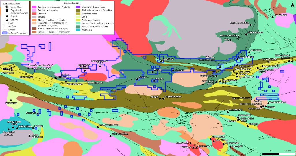
Bedrock Geology — Full Property
Orogenic Gold
Primary target type — quartz-carbonate vein systems associated with major shear zones including the Disson, Laflamme, Laberge, and Clermont structures. Property-wide historical exploration has confirmed gold mineralization along these corridors, which share structural continuity with the trends hosting discoveries on adjacent properties.
VMS / Base-Metal Potential
The Normétal Volcanic Belt has a significant VMS mining history. Historical exploration has identified base-metal mineralization across the property, and the presence of felsic volcanic sequences suggests additional VMS upside that remains underexplored.
Structural Framework
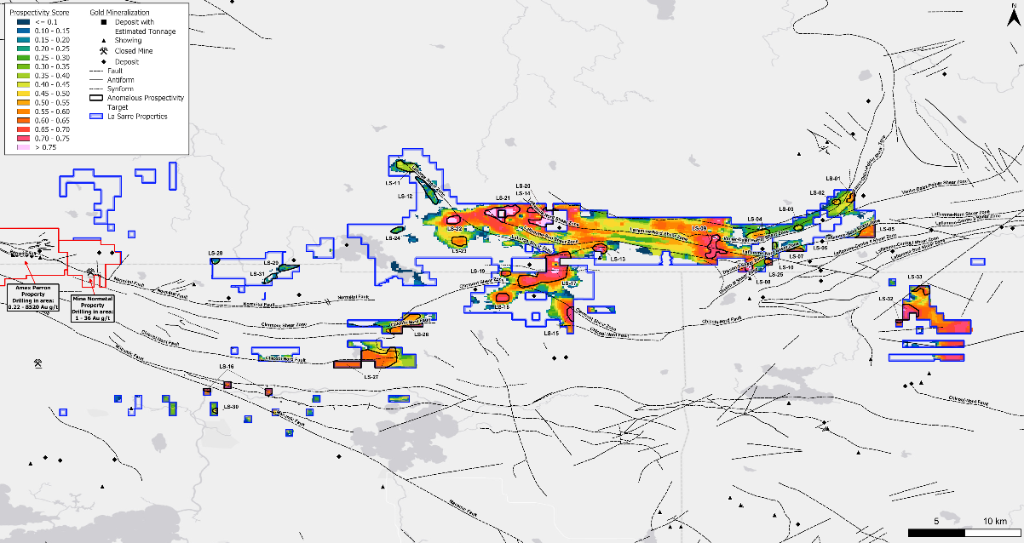
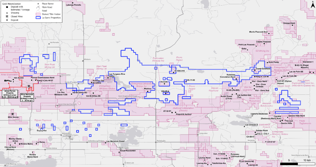
Multiple major shear zones traverse the property: Disson II/III, Laflamme-Nord/Centre/Sud, Laberge, Clermont, Vanier-Dalet-Poirier, and the Chicobi-Nord Fault — providing extensive structural corridors for fluid flow and mineralization.
A Discovery Story Grounded in Structural Context
Property-Wide Mineralization Confirmed
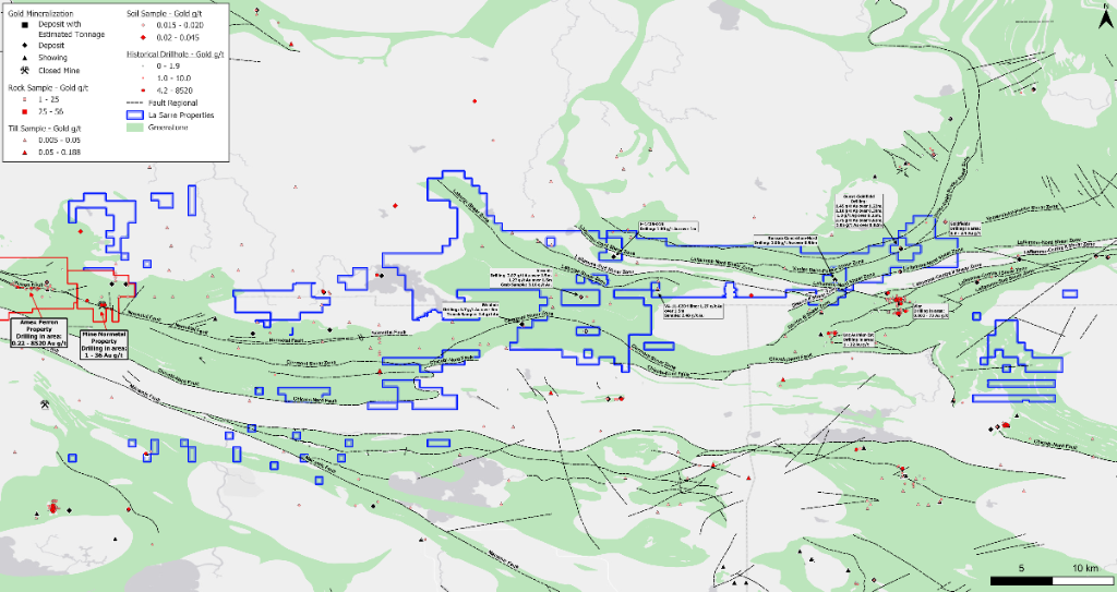
Historical exploration across the property has consistently confirmed property-wide gold mineralization along multiple shear corridors, establishing the district-scale orogenic gold potential of the land position.
Shared Structural Corridors
Mineralized showings have been identified along the Disson, Laflamme, Laberge, and Clermont shear zones — the same structural trends that host significant gold discoveries on adjacent properties, including Amex Exploration's Perron Project and Vior's Ligneris Project.
Multi-Style Geological Potential
Both orogenic gold and VMS/base-metal mineralization styles have been documented property-wide, confirming the geological diversity and upside of the land position.
Historical Data Caution: Historical exploration results referenced have not necessarily been verified by a Qualified Person and should not be relied upon. The Company has not undertaken sufficient work to verify historical results and treats them as relevant but unconfirmed context for exploration planning. Mineralization hosted on adjacent properties is not necessarily indicative of mineralization on the Company's properties.
Priority Target Corridors
LS-08
0.76Disson Shear Zone
#1 Critical Priority
Goldcana's highest-ranked exploration target (AI score 0.76), located along the Disson Shear Zone in the eastern portion of the La Sarre Project, directly adjoining Vior's Ligneris Project — approximately 500 metres from Vior's high-grade South Zone. Vior's 2026 program has expanded the South Zone to more than 1.3 km laterally with high-grade mineralization to ~805 m vertical depth. The AI-defined footprint of LS-08 remains undrilled.
- AI score: 0.76 — highest of 33 targets
- ~500 m from Vior's high-grade Ligneris South Zone
- Vior South Zone extended >1.3 km; high-grade to ~805 m depth
- Undrilled at the AI-defined footprint
LS-07
0.67Disson Shear Zone
#2 Elevated — Vior Timing Adjustment
Elevated from AI rank #11 to operational priority #2 in the June 2026 v7 update. LS-07 carries the highest lithology sub-score of all 33 targets (0.90). Located ~2 km SW of LS-08 on the same Disson Shear Zone corridor. Vior's SW extension at LI-26-028 projects directly toward LS-07, making the LS-08/LS-07 linked pair a >3 km undrilled prospective corridor.
- Lithology sub-score 0.90 — highest of all 33 targets
- ~2 km SW of LS-08 on Disson Shear Zone
- Vior June 2, 2026 SW extension projects toward LS-07
- Undrilled at the AI-defined footprint
LS-25
0.56Disson Shear Zone
High Priority — Corridor Extension
Corridor extension target on the Disson Shear Zone, complementing the LS-08 / LS-07 linked pair. Part of the North Ligneris / Disson structural corridor that defines the Phase 1 competitive priority zone.
- Disson Shear Zone — same corridor as LS-08 and LS-07
- High priority (AI score 0.56)
- Along-strike corridor expansion target
Additional Target Clusters
Laflamme
Laflamme-Nord, Laflamme-Centre I/II, Laflamme-Sud shear zones
Laberge
Laberge Shear Zone targets
Clermont
Clermont Shear Zone targets
Macamic
Macamic Fault area targets
Vanier-Dalet-Poirier
Vanier-Dalet-Poirier Shear Zone targets
Chicobi-Nord
Chicobi-Nord Fault area targets
Technical Map Gallery
2026 Exploration Plan
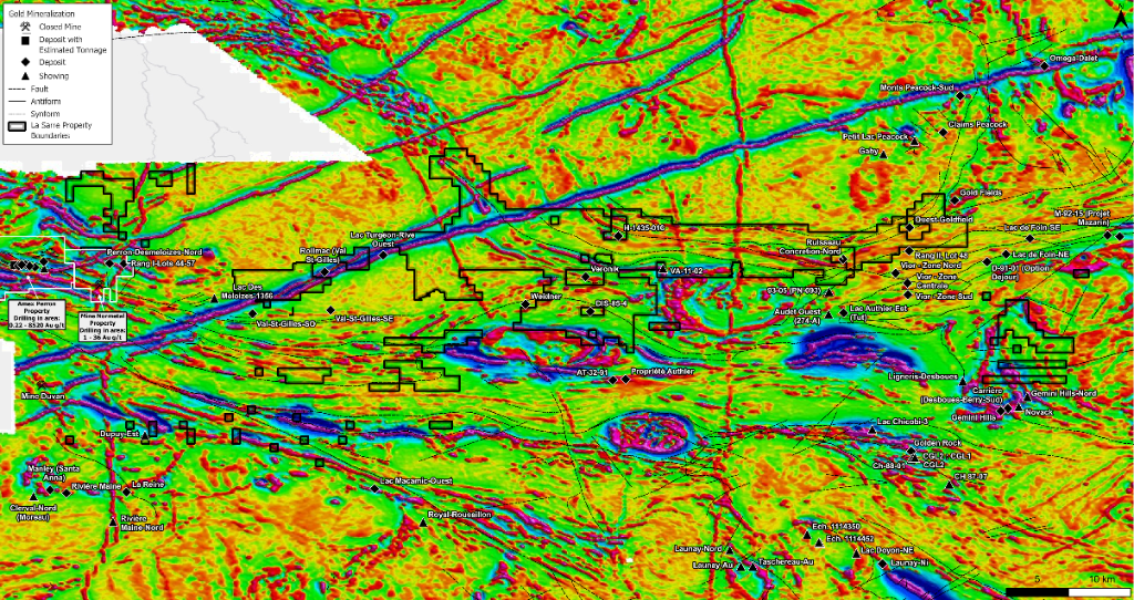
Detailed compilation and target refinement, reprocessing and interpretation of geophysical data, 3D modelling of historical drilling, and geological mapping and geochemical sampling — prioritizing LS-08 and the Disson corridor before advancing selected targets toward diamond drilling. Subject to receipt of permits and regulatory approvals.
Want the Full Technical Package?
Contact our IR team for the complete technical presentation, map package, and exploration plan details.
Stay Informed
Sign up to receive exploration updates, news releases, and investor alerts as the 2026 La Sarre program advances.
No spam. Unsubscribe at any time.