AI Targeting &
Exploration Strategy
Mercator's AI-assisted, geologist-led targeting platform integrates hundreds of geoscience data layers to identify and rank gold targets — but geologists remain in charge of exploration decisions.
Top-ranked targets with the highest prospectivity scores, prioritized for Phase 1 drilling.
Strong targets for follow-up field work and potential drill testing in later phases.
Additional targets providing district-scale optionality across the property.
From Data to Discovery
Data Integration
Up to 500 layers of geoscience data compiled and standardized into a single spatial framework.
AI Prospectivity Model
Machine learning model generates a prospectivity score from 0 to 1 for every point on the property.
Target Identification
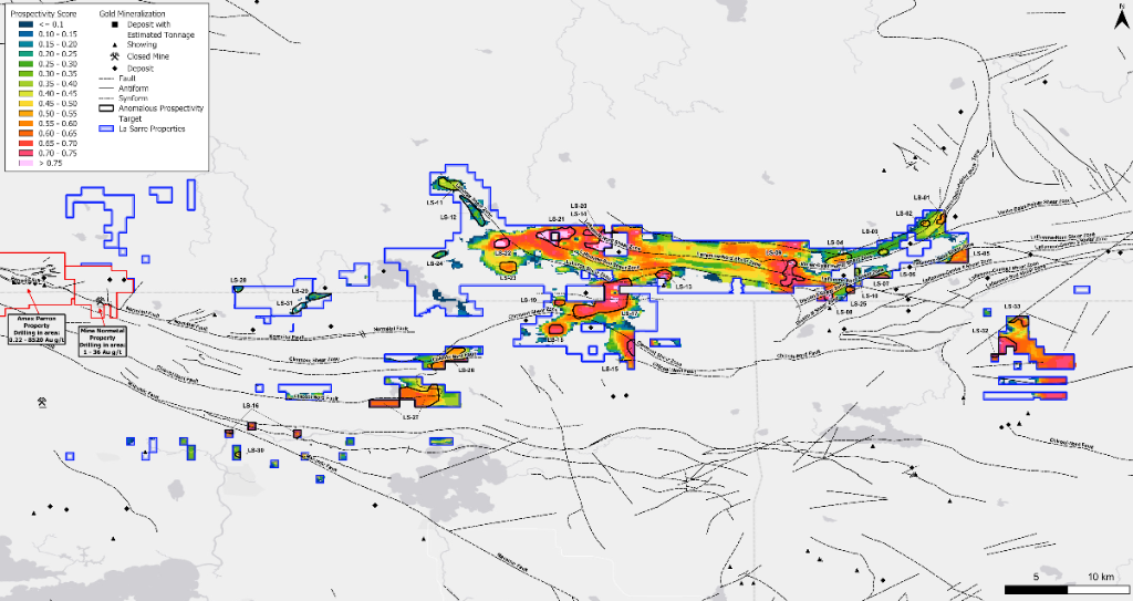
33 anomalous prospectivity targets identified and ranked by score, geological favourability, and accessibility.
Geologist Validation
Targets are reviewed and validated by experienced geologists before field work — AI focuses, humans decide.
Field Verification
Mapping, sampling, and ground truthing confirm model predictions before committing drill capital.
Drill Testing
Priority targets are drill-tested with focused, data-supported hole placement — not speculative grid drilling.
500+ Layers of Geoscience Data
Geochemistry
Historical soil, till, and rock sample assays — including gold, pathfinder elements, and multi-element data.
Lithology
Bedrock geology maps, volcanic and intrusive rock types, and stratigraphic relationships.
Magnetics
Airborne and ground magnetic surveys revealing structural architecture and lithological contacts.
Lineaments
Structural lineament analysis — faults, shear zones, and structural corridors from geophysics and mapping.
33 AI-Identified Gold Targets
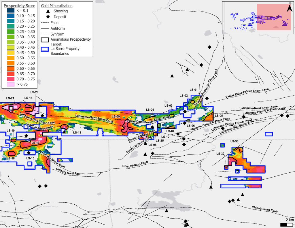
Prospectivity Map — East Section
LS-07, LS-08, LS-25 and other targets along the Disson corridor
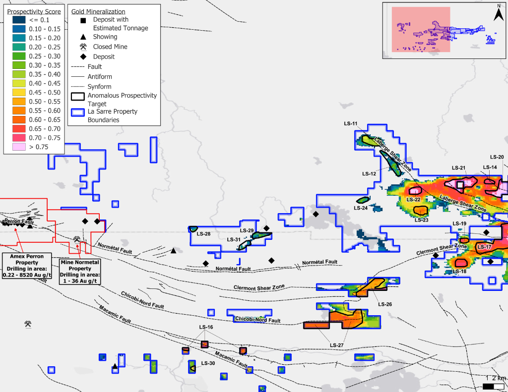
Prospectivity Map — West Section
Western targets including LS-11 through LS-31 clusters
Top-Ranked AI Targets
Highest overall AI score. Disson Shear Zone. Top priority for 2026 drilling.
Highest lithology sub-score (0.90). Elevated due to Vior Ligneris extension results.
Part of the North Ligneris / Disson corridor expansion story.
AI Focuses. Geologists Decide.
The AI targeting model does not replace field work. It focuses and prioritizes exploration — identifying where geological, geochemical, and geophysical data collectively suggest the highest prospectivity for gold mineralization.
But targets are only starting points. Human geological validation, structural mapping, ground geophysics, geochemical sampling, and ultimately drilling remain essential to testing and refining these targets.
Data-supported exploration, geologist-led decisions, disciplined capital deployment.
Stay Informed
Sign up to receive exploration updates, news releases, and investor alerts as the 2026 La Sarre program advances.
No spam. Unsubscribe at any time.